Fireworks Over the Lake, a picnic and a tractor pull — the latest Manitowoc outdoors report
Bob Schuh has the latest outdoors news from across Manitowoc County and beyond.
Larrabee Sportsmans Club will have Fireworks Over the Lake July 20.
The club will open at 4 p.m. that day with fireworks at dark. Food trucks will be available.
Larrabee Sportsmen’s Club is at 16306 Harpt Lake Road, Mishicot, 2 miles north of State 147.
Clarks Mills club’s annual Picnic and Tractor Pull is July 20
Clarks Mills Sportsmans Club’s annual Picnic and Tractor Pull is July 20 at the club. Rain date is July 21.
The club is at 81 Sportsman Lane, Clarks Mills, 1.5 miles west of County J on Clarks Mills Road.
Picnic and cornhole tournament starts at noon. Tractor pull starts at 4 p.m. Weigh-in is from 1 to 3 p.m.
Cash raffle drawing will be held after the tractor pull with only 500 tickets sold. Any available tickets will be sold at the clubhouse until gone.
Food and beverages will be available.
Read last week’s column:8 Wisconsin elk hunters selected for 2024 hunt, and more in the latest Manitowoc outdoors report
Deadline to apply for Upriver Lakes sturgeon spearing tags nears
Wisconsin Department of Natural Resources reminds sturgeon spearers the deadline to apply for Upriver Lakes spearing tags is Aug. 1.
Because of a higher success rate on the Upriver Lakes, only 500 license holders will be selected to spear a sturgeon from lakes Poygan, Winneconne or Butte des Morts during the 2025 sturgeon spearing season.
These spearing tags will be issued through a drawing where priority is given to applications with the most preference points. Those applying as a group will have their point value based on the individual with the lowest points within the group. Spearers can also choose to purchase a preference point instead of applying for a tag.
Applicants selected to purchase an Upriver Lakes sturgeon spearing license will be notified by Oct. 1.
Any license-holder not selected during this drawing will be awarded a preference point toward future drawings and can purchase a Lake Winnebago spearing license. Spearers can apply for an Upriver Lakes tag or purchase a preference point online through the Go Wild system or from any license vender.
The 2025 Winnebago System sturgeon spearing season will begin Feb. 8, 2025, on Lake Winnebago and the upriver lakes Poygan, Winneconne and Butte des Morts. The season is authorized for a maximum of 16 days, or until any of the annual biologically based harvest caps is reached. Separate harvest caps are set for each system: Lake Winnebago and the Upriver Lakes.
Manitowoc Gun Club hosts youth shooting program July 16
Northeast Wisconsin Youth Shooting Program, Inc., will hold its next shoot at Manitowoc Gun Club, 3112 Clover Road, just south of Manitowoc, July 16.
Youth ages 18 and younger will get a free round of targets, either trap or skeet, plus a free box of shells to shoot the round.
Shooting will be 4:30 to 7 p.m.
If this is your first shoot of the summer, a parent will need to sign the release forms before a youngster can shoot. If you did the shoot earlier in Maribel, another form does not need to be signed.
DNR launches updated Public Access Lands map app
The DNR announced a new web mapping application is available for people to learn about public lands in Wisconsin and plan their next outdoor adventure.
The Public Access Lands application is designed for desktop and mobile devices and offers user-friendly tools. From state natural areas to state trails, lakeshores and rivers, Wisconsin has a wealth of public lands for everyone to enjoy.
The Public Access Lands application makes it easy to locate a state park, county forest or lake for hiking, hunting or fishing, a news release said. The Open Managed Forest Law/Forest Crop Law properties are also included in this update.
“The updated Public Access Lands map app has been simplified with an uncluttered screen and easy-to-use tools,” said Ann Scott, DNR real estate land records officer. “Click on the screen to open links to find information on DNR properties, public access, open private lands for hunting and other helpful features to find the perfect getaway.”
This web-based mapping application provides up-to-date property information, including maps, restricted areas and links to webpages, if available. To find specific opportunities, such as fishing waters or hunting zones, select which “theme” interests you, and the application will display layers relevant to the activity.
The application also shows DNR parking areas and boat access sites and complements the printed Public Access Lands Atlas, which contains 441 maps covering statewide public lands, roads and waterways.
Launch the Public Access Lands application or visit the DNR’s Public Access Lands webpage to learn more.
More Bob Schuh:Click here for more outdoors columns by Bob Schuh
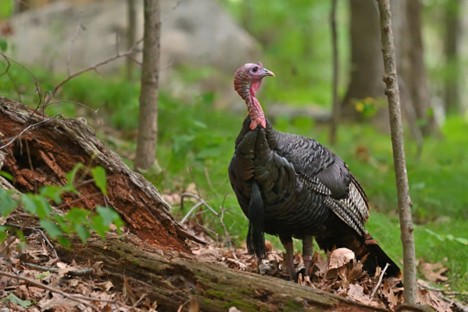
Turkeys frequent visitors to northeast side of Manitowoc

That’s it for this week, so have fun in the great outdoors.
You may also like
-
Manitowoc outdoors news: Collins Marsh Fun Fest & latest on Izaak Walton League vandalism
-
Conservationists HOF inductees revealed, reward launched in vandalism case: Latest Manitowoc outdoors news
-
Bob Schuh shares the latest outdoors news
-
Vandals destroy Izaak Walton League project & more in the latest Manitowoc outdoors report
-
Manitowoc outdoors report shares why more yearling deer are hit on roads this time of year
